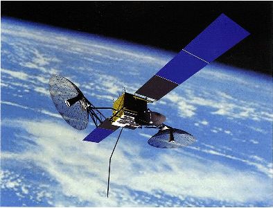
Video Clip: Click to Watch
ATI presents:
An overview of commercial satellite communications hardware, operations, business and regulatory environment
This three-day introductory course has been taught to rave reviews to thousands of industry professionals for over two decades. The material is frequently updated and the course is a primer to the concepts, jargon, buzzwords, and acronyms of the industry, plus an overview of commercial satellite communications hardware, operations, and business environment.
Here is Dr. Mark R. Chartrand, course instructor, on YouTube.
Since 1984, the Applied Technology Institute (ATI) has provided leading-edge public courses and onsite technical training to DoD and NASA personnel, as well as contractors. Whether you are a busy engineer, a technical expert or a project manager, you can enhance your understanding of complex satellite systems in a short time. You will become aware of the basic vocabulary essential to interact meaningfully with your colleagues.
Here is more about the course.
SATELLITE COMMUNICATIONS COURSE — AN ESSENTIAL INTRODUCTION
The first section provides non-technical people with the technical background necessary to understand the space and earth segments of the industry, culminating with the importance of the link budget. The concluding section of the course provides an overview of the business issues, including major operators, regulation and legal issues, and issues and trends affecting the industry.
What You Will Learn:
• How do commercial satellites fit into the telecommunications industry?
• How are satellites planned, built, launched, and operated?
• How do earth stations function?
• What is a link budget and why is it important?
• What legal and regulatory restrictions affect the industry?
• What are the issues and trends driving the industry?
The course is intended primarily for non-technical people who must understand the entire field of commercial satellite communications, and who must understand and communicate with engineers and other technical personnel. The secondary audience is technical personnel moving into the industry who need a quick and thorough overview of what is going on in the industry.
Concepts are explained at a basic level, minimizing the use of math, and providing real-world examples. Several calculations of important concepts such as link budgets are presented for illustrative purposes, but the details need not be understood in depth to gain an understanding of the concepts illustrated.
Course Outline, Samplers, and Notes
Our short courses are designed for individuals involved in planning, designing, building, launching, and operating space and satellite systems.
Don’t believe it?
Here is what one of our recent students had to say about this course.
“I truly enjoyed your course and hearing of your adventures in the Satellite business. You have a definite gift in teaching style and explanations.”
Still not convinced?
You can see for yourself the value of our course before you sign up.
View Satellite Course Sampler
You can also check out some of our other short courses on the ATI YouTube channel.
Attendees receive a copy of the instructor’s new textbook, Satellite Communications for the Non-Specialist, and will have time to discuss issues pertinent to their interests.
After completing the course, you will also receive a certificate of completion. Please visit our website for more valuable information.
About ATI and the Instructors
Our mission here at ATI is to provide expert training and the highest quality professional development in space, communications, defense, sonar, radar, and signal processing. We are not a one-size-fits-all educational facility. Our short classes include both introductory and advanced courses.
ATI’s instructors are world-class experts who are the best in the business. They are carefully selected for their ability to clearly explain advanced technology.
Dr. Mark R. Chartrand is a consultant and lecturer in satellite telecommunications and the space sciences. For more than 25 years he has presented professional seminars on satellite technology and telecommunications to satisfied individuals and businesses throughout the United States, Canada, Latin America, Europe and Asia.
Dr. Chartrand has served as a technical and/or business consultant to NASA, Arianespace, GTE Spacenet, Intelsat, Antares Satellite Corp., Moffett-Larson-Johnson, Arianespace, Delmarva Power, Hewlett-Packard, and the International Communications Satellite Society of Japan, among others.
He has appeared as an invited expert witness before Congressional subcommittees and was an invited witness before the National Commission on Space.
He was the founding editor and the Editor-in-Chief of the annual The World Satellite Systems Guide, and later the publication Strategic Directions in Satellite Communication. He is author of six books and hundreds of articles in the space sciences. He has been chairman of several international satellite conferences, and a speaker at many others.
Times, Dates, and Locations
The times, dates and locations of our Satellite Communications – An Essential Introduction short course are as follows:
Sep 20-22, 2011 Cocoa Beach
Nov 29-Dec 1, 2011 Laurel, MD
Apr 17-19, 2012 Columbia, MD